Photo: Cook River New Zealand Aerial
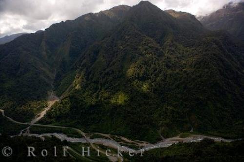
Aboard a helicopter tour, you get an aerial view of the Cook River rushing through the mountainous landscape of Mount Cook on the South Island of New Zealand.
Flying on a helicopter tour with Glacier Helicopters, you will see the area of Mount Cook National Park on the South Island of New Zealand in a whole new perspective. This aerial picture lets you see how the Cook River which originated from the Fox Glacier, meanders its way through the mountainous landscape.
There are nineteen different mountain peaks throughout Mount Cook National Park with Mount Cook being the highest. The Cook River is not the only river that flows through the mountain area as tributaries meet up in all directions.
Nearly half of the landscape is made up of rock and ice due to the glaciers and unique alpine plants flourish in this type of ground. Summer months bring out the Mountain Daisies and other wildflowers as well as the amazing sight of the fast moving Cook River. This is when you will find hikers and backpackers taking to the mountains for days at a time.
Cook River New Zealand Aerial

Pictures from photo gallery "Kaikoura Pictures"
This picture is part of the photo album "Westland National Park" - there are more beautiful images waiting for you.
Related stock photo galleries, pictures & travel ideas:
Cook River New Zealand Aerial
... Helicopters takes you on a forty minute scenic excursion over Mount Cook National Park, Fox Glacier and Franz Josef Glacier where you can take spectacular aerial pictures of the landscape. Seeing this area around the South Island of New Zealand by air lets you discover a peaceful wilderness created by Mother Nature. Rivers like the Cook River that flow from the Fox Glacier have created gorges in the mountains so they can make their way downstream.
Cook River which flows from Fox Glacier seen during a Mount Cook Spectacular with landing flight (40 minutes) with Glacier Helicopters, Westland National Park, West Coast, South Island, New Zealand.
Technical Information:
I photographed this photo with the digital SLR camera model Canon EOS-1Ds Mark II, aperture of f/5.0, exposure time of 1/250 sec. on ISO 100, as always I used a original Canon Lens, the focus lenght for this picture was 24mm.
Aboard a helicopter tour, you get an aerial view of the Cook River rushing through the mountainous landscape of Mount Cook on the South Island of New Zealand.
