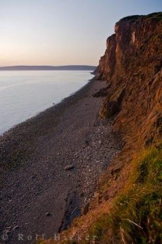
Photo: Dramatic Coastal Cliffs Sunset Beach Canadian Maritimes
The Dramatic Cliffs below the Cape d'Or Lighthouse have been shaped by the strong tides of the Bay of Fundy in Nova Scotia, Canada - part of the beautiful Canadian Maritimes region.
The dramatic Cape d'Or cliffs fringe the coastline, as seen from the lighthouse of the same name, in Nova Scotia, Canada, were named (actually misnamed) by the explorer, Samuel de Champlain in the early 17th century. He mistook the ore nuggets, shining in the cliffs, for gold, when, in fact they were copper. Even today, there are still some nuggets to be found in the vicinity.
Over the centuries, the tides of the Bay of Fundy, in the Canadian Maritime province of Nova Scotia, which are the highest tides in the world, have shaped the Cape d'Or cliffs into a steep, and therefore dangerous headland. Although the Cape d'Or Lighthouse warns the shipping traffic with the light and foghorn, visitors, on foot, to the top of the cliffs should be aware the edge is grass-covered and difficult to define. ... continue below the picture...
Dramatic Coastal Cliffs Sunset Beach Canadian Maritimes

Pictures from photo gallery "Canon Eos-1ds"
This picture is part of the photo album "Sunset Pictures" - there are more beautiful images waiting for you.
Related stock photo galleries, pictures & travel ideas:
Dramatic Coastal Cliffs Sunset Beach Canadian Maritimes
There is protective fencing, but care should still be taken with youngsters and pets. The cliffs and lighthouse of Cape d'Or is one of the stops along the Glooscap Trail, which is part of the Fundy Shore Ecotour, featuring the fascinating coastline of this beautiful area of the Canadian Maritimes.
Dramatic coastline seen from the Cape d'Or Lighthouse, Cape d'Or, CapeChignecto, Bay of Fundy, Fundy Shore Ecotour, Glooscap Trail, Highway 209, Minas Channel, Nova Scotia, Canada.
Technical Information:
I photographed this photo with the digital SLR camera model Canon EOS-1Ds Mark II, aperture of f/5.6, exposure time of 1/80 sec. on ISO 100, as always I used a original Canon Lens, the focus lenght for this picture was 27mm.
The Dramatic Cliffs below the Cape d'Or Lighthouse have been shaped by the strong tides of the Bay of Fundy in Nova Scotia, Canada - part of the beautiful Canadian Maritimes region.
