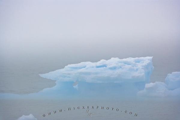
Photo: Pack Ice Fog Strait Belle Isle Newfoundland
Pack ice can be seen on a foggy day in the Strait of Belle Isle from Sandy Cove along Highway 430 which is part of the world famous Viking Trail on the Great Northern Peninsula in Newfoundland, Canada.
Pack ice can be seen in the Strait of Belle Isle even during a foggy day, from Sandy Cove, which is situated along the world famous Viking Trail on the Great Northern Peninsula in Newfoundland, Canada. Sandy Cove is a very small town of only about 160 people and is part of what is known as the Trails to the Vikings, or the Viking Trail, a scenic route that many people travel on when they come to this area of Newfoundland. This trail leads to an old viking settlement that is a thousand years old.
This pack ice was seen in the Strait of Belle Isle, which is an area of water that separates the Labrador Peninsula from Newfoundland. It is a very treacherous place to travel by boat and can contain sea ice for eight to ten months of the year; needless to say it is very cold. ... continue below the picture...
Pack Ice Fog Strait Belle Isle Newfoundland

Pictures from photo gallery "Blue Background"
This picture is part of the photo album "Ice Pictures" - there are more beautiful images waiting for you.
Related stock photo galleries, pictures & travel ideas:
Pack Ice Fog Strait Belle Isle Newfoundland
... It also can be very foggy at times, such as on the day this photograph was taken, generally because of the weather systems constantly moving over this cold sea surface of ice, fog is a staple of life in this area.
Pack ice is when the sea freezes and forms an icy crust on the surface of the water; it floats and can move and can become bigger or smaller depending on the season and temperature. It can be both loose ice and ice that is attached to the shore. The varying shapes of the pack ice are formed by the motion of the sea water, and the sheets of ice moving against one another which forms ridges.
Pack ice in the Strait of Belle Isle seen from Sandy Cove during a foggy day along Highway 430, Trails to the Vikings, Viking Trail, Great Northern Peninsula, Northern Peninsula, Newfoundland, Canada.
Technical Information:
I photographed this photo with the digital SLR camera model Canon EOS-1Ds Mark II, aperture of f/6.3, exposure time of 1/500 sec. on ISO 100, as always I used a original Canon Lens, the focus lenght for this picture was 250mm.
Pack ice can be seen on a foggy day in the Strait of Belle Isle from Sandy Cove along Highway 430 which is part of the world famous Viking Trail on the Great Northern Peninsula in Newfoundland, Canada.
