Photo: Pinware River Mouth Scenery Southern Labrador
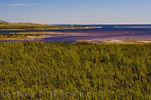
The Labrador Coastal Drive in Southern Labrador is very pretty as we stop to enjoy the scenery of the Pinware River Mouth and the icebergs floating by.
From a viewpoint along the Labrador Coastal Drive in Southern Labrador, we stopped to see the stunning scenery of the Pinware River Mouth where icebergs can be seen in the distance. Low tide bares the muddy bottoms of the Pinware River while water encircles the small islands with greenery flourishing on top.
Dense forest adorns the foreground of this picture and stops along the banks of the Pinware River Mouth in Southern Labrador where the river branches off in many directions. The deep blue colored water meanders its way around the sand flats before heading out to sea.
On the opposite side of the Pinware River, you can walk along the narrow stretch of land for a different look at the scenery and a closer view of the icebergs. The Strait of Belle is often visited by large massive icebergs that are slowly starting to diminish as they make their way past the Pinware River Mouth. Be aware of any signs of blows from the whales that are seen off the coast of Southern Labrador. ... continue below the picture...
Pinware River Mouth Scenery Southern Labrador

Pictures from photo gallery "Waterfall Pictures"
This picture is part of the photo album "Pinware River Provincial Park" - there are more beautiful images waiting for you.
Related stock photo galleries, pictures & travel ideas:
Pinware River Mouth Scenery Southern Labrador
- Atlantic Canada (1154)
- Atlantic Ocean (74)
- Canada (6388)
- Eastern Canada (1337)
- Honeymoon Canada (866)
- Iceberg (216)
- Labrador Coastal Drive (73)
- Labrador (143)
- Newfoundland Labrador (1086)
- Ocean (335)
- Pinware River Provincial Park (12)
- River (584)
- Strait Of Belle Isle (35)
- Viking Trail (790)
- Water (1551)
The Labrador Coastal Drive can take as long as you like or you can do it fairly quickly depending on how many stops you decide to take. Rugged wilderness, spectacular sunsets, unique towns and villages and a variety of wildlife is what the Labrador Coastal Drive in Southern Labrador is all about.
Be sure to bring your camera as the scenery around Southern Labrador is breathtaking. The Pinware River Mouth is one of the most beautiful places around this Provincial Park so be sure to take your time exploring while driving through.
Pinware River mouth, islands, and icebergs seen from along the Labrador Coastal Drive, Highway 510, Viking Trail, Trails to the Vikings, Strait of Belle Isle, Southern Labrador, Labrador, Atlantic Canada, Canada.
Technical Information:
I photographed this photo with the digital SLR camera model Canon EOS-1Ds Mark II, aperture of f/7.1, exposure time of 1/80 sec. on ISO 100, as always I used a original Canon Lens, the focus lenght for this picture was 70mm.
The Labrador Coastal Drive in Southern Labrador is very pretty as we stop to enjoy the scenery of the Pinware River Mouth and the icebergs floating by.
