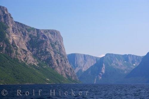
Photo: Western Brook Pond Scenery Gros Morne National Park Newfoundland
Stunning scenery and ancient geology await the visitor to Western Brook Pond in Gros Morne National Park on the Northern Peninsula of Newfoundland, Canada.
Fringed by the majestic scenery of sheer cliff faces which tower to around 600 metres, it is easy to see that Western Brook Pond had it's beginnings as a glacier carved fjord.
The cliffs, which belong to the Long Range Mountains (and therefore the Appalachian Mountains), were created after glaciers carved the fjord out of the plateau. Eventually, once the glaciers melted, the land formed over the entrance to the fjord and cut it off from the sea. After many years the trapped salt water was replaced by fresh water.
Western Brook Pond seen from a tour boat, Gros Morne National Park, UNESCO World Heritage Site, Viking Trail, Trails to the Vikings, Highway 430, Northern Peninsula, Great Northern Peninsula, Newfoundland Labrador, Newfoundland, Canada.
Western Brook Pond Scenery Gros Morne National Park Newfoundland

Pictures from photo gallery "Geological Pictures"
This picture is part of the photo album "Newfoundland Pictures" - there are more beautiful images waiting for you.
Related stock photo galleries, pictures & travel ideas:
Western Brook Pond Scenery Gros Morne National Park Newfoundland
- Atlantic Canada (1154)
- Canada (6388)
- Canadian National Park (302)
- Eastern Canada (1337)
- Geological (31)
- Gros Morne National Park (107)
- Honeymoon Canada (866)
- Lake (482)
- Landscape (431)
- Long Range Mountains (11)
- Mountain (489)
- National Parks (487)
- Newfoundland Labrador (1086)
- Newfoundland (1018)
- Northern Peninsula (108)
- Scenic (643)
- UNESCO World Heritage Site (443)
- Viking Trail (790)
- Water (1551)
- Western Brook Pond (11)
Technical Information:
I photographed this photo with the digital SLR camera model Canon EOS-1Ds Mark II, aperture of f/6.3, exposure time of 1/160 sec. on ISO 100, as always I used a original Canon Lens, the focus lenght for this picture was 70mm.
Stunning scenery and ancient geology await the visitor to Western Brook Pond in Gros Morne National Park on the Northern Peninsula of Newfoundland, Canada.

